Gallicano: Discovering the ancient aqueducts
Autore: GoTellGo Archaeology
Goteller: Redazione GoTellGo
Categoria: archeologia
Creato il: 03/06/2010
Data Da: 01/11/1993
Data A: 01/11/1993
Licenza:

Nazioni: Italy
: gallicano nel lazio
Posti visitati: Gericomio, S. Vittorino, Ponte S. Antonio, Ponte Lupo, Ponte S. Pietro, Ponte della Mola, Via di Poli
Parole chiave: Aqua Claudia, Anio Novus, Aqua Marcia, Anio Vetus, roman aqueducts
A visit to the imposing remains of the Anio Vetus, Aqua Marcia, Anio Novus and Aqua Claudia aqueducts in the Prenestine area is a delightful and fascinating itinerary.
These four aqueducts provided almost 70% of the city’s water supply and got their water from the upper Anien valley. Having run parallel for a long stretch of the valley as far as the Tiburtine plain, they were then divided by the hills of the Prenestine countryside to reflank again past the Alban Hills and follow the Via Appia and the Via Tuscolana to Rome. Their route which was a long one given the need to maintain a constant incline to allow the water to flow naturally, was for the most part underground, but crossing the valley the aqueducts emerged from underground to become some striking artificial bridges.
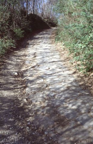
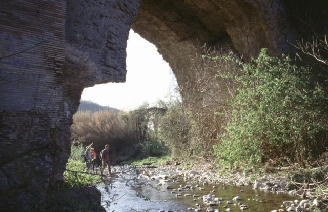
At the 30th Kilometre of the road to Poli, taking the road for S. Gregorio, after some 800 metres we come across an old semidestroyed mill. From this a path branches off on the right following the traces of an ancient Roman flag-stoned road. After a few hundred metres we come to the bridge of the Mill on the Mola gully. This was part of the Anio Vetus, was built between 272 and 269 B.C. by the censors Manius Curius Dentatus and Fulvius Flaccus and consisted of a dual order of 22 arches some 156 metres long and 24.5 metres high. The bridge, in opus mixtum, had a four-meter incline as can be seen from the last three arches. The condition of the bridge has progressively worsened since 1965. The water in the gully caused some of the arches to collapse and in 1982 some local farmers, worried about the dangerous state of some of the arches had them pulled down.
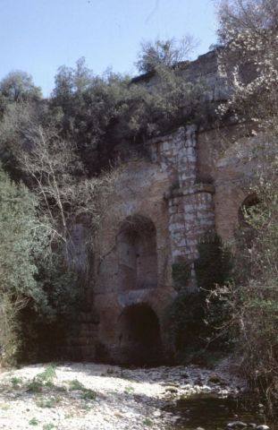
Continuing along the this path we come across the Aqua Marcia which is hidden in thick vegetation. This was used to cross the Mola gully across the St. Peter bridge. It was 90 metres long and 19 high and was built by the praetor Quintus Marcius Rex in 144 B.C. with square travertine blocks. The bridge, which has a central arch flanked by other small arches, was later faces with opus mixtum during the reign of Titus and still later strengthened with buttresses under the Severe emperors and Diocletian.
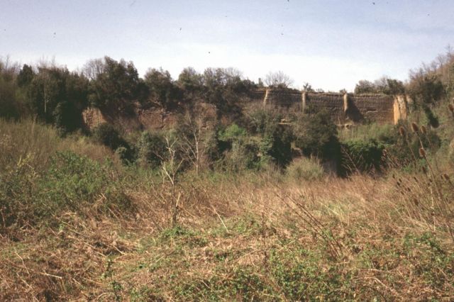
The Lupo bridge which spans the Acqua Rossa gully is a masterpiece of hydraulic engineering, is also part of the Aqua Marcia conduit and can be reached by taking a small path at the 31st kilometre of the road to Poli (on the left coming from Poli). The bridge, hidden by thick vegetation, which makes it even more picturesque, is 115 metres long, between 18 and 25 metres wide and 30 metres high. The various attempts to restore it can be clearly seen. Only the two central arches in square tufa blocks date back to the era of Quintus Marcius Rex while the reticulated tufa third arch, some of the buttresses and the smaller arches supporting the canal along which the water flowed, date back to the days of Agrippa. Later, with Augustus, the main arch was walled and the entire structure bricked and reticulated. It was further strenghtened under Titus and Hadrian while Caracalla built the double row of under-arches and the massive buttressed supporting wall along the entire upstream wall.
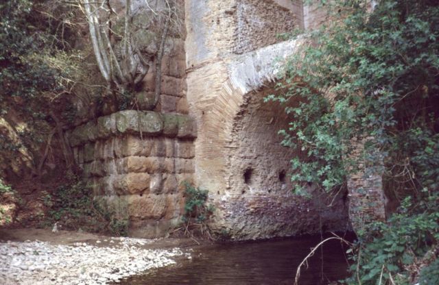
On the road from S. Vittorino to Gericomio a small path on the right, just outside the entrance to the village, lead to the St. Anthony bridge, which belonged to the Anio Novus and spans the Acqua Raminga gully. The bridge got its name from the shrine, now lost and dedicated to St. Anthony which used to stand on the area. This grandiose bridge was 125 metres long and 33 high and was built by Claudius in 52 A.D. with square tufa and calcareous ashlar blocks and has one wider arch flanked by six other arches on the northern side and two smaller arches on the southern side. There are traces of brickwork used to reinforce the bridge in the 4th and the 5th centuries A.D. when some even smaller arches were added.
Immagini associate